TubeX
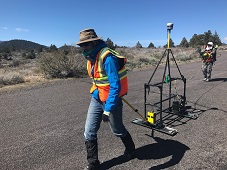
Lava tubes have been studied on Earth since the late 1960's when geologists observed active lava tubes on Hawai'i. Tubes on other planetary bodies, however, have only been studied through remote sensing. In as early as themed 1970's, it was postulated that these planetary tubes could provide safe havens for human crews and protect their life support equipment from harmful radiation, rapidly fluctuating surface temperatures, and even meteorite impacts(Horz,1975). What is not clear, however, is how a human crew will characterize a tube-rich environment in preparation for habitation. The study will address this knowledge gap using a suite of instruments in an analog study. Ground Penetrating Radar (GPR), Light Detection And Ranging (LiDAR), and handheld X-ray fluorescence spectroscopy (hXRF) are all techniques that have been deployed on Earth in a variety of geologic contexts with great success. They have never before been combined in a volcanic setting to investigate lava flow emplacement processes nor have any of them been applied to develop human exploration strategies for the examination of another planetary surface.
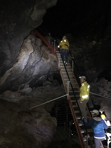
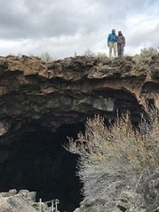
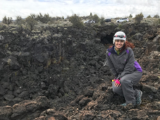
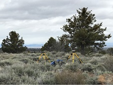
In order to develop this concept of operations for tube exploration, we will deploy GPR, LiDAR, and hXRF field instruments at the Lava Beds National Monument, California. Lava tubes at Lava Beds NM range in length, depth and complexity. This range of complexity is particularly well suited to this project as tube geometry present on other planetary surface is completely unknown.
SIGKit
A toolkit to boost introductory geophysics and field geophysics instruction
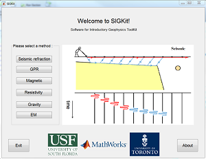
We propose to develop a software toolkit that will enable students to model, process, visualize, and interpret geophysical field data in a context that distills and clarifies the underlying physics. This toolkit fills a critical void in educational materials necessary to achieve key geophysics learning outcomes. It will expand active learning in classroom-based courses and provide a means to include survey planning and real-time data analysis in introductory field experiences. The software, programmed using MATLAB code, will be offered as an easy-to-use graphical user interface and packaged so it can run as an executable in the field even on computers without MATLAB licenses.